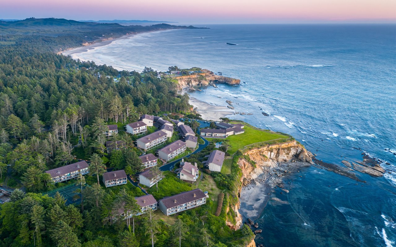
If you live on Otter Crest Loop or off C Avenue, the summer you're in right now is not quite the summer you had last August. The village itself is the same 225-or-so residents, the same handful of interlacing streets, the same collapsed sea cave at the end of 1st Street. What has shifted is the machinery around it. A quiet piece of state parks policy went live this spring, a familiar volunteer program is out in force through Labor Day, and the timing of everything a resident actually cares about, which is when the loop is drivable and when the Marine Gardens are worth walking to, now runs on a slightly different clock.
The point of this post is not to catalog what's here. You already know what's here. The point is to describe how the pressure of Otter Rock's roughly 900,000 annual visitors is being redistributed this year, and where a resident's daily rhythm actually lives inside that shift.
The Punchbowl is the same. The parking, the stewardship, and the shoulder-hour windows around it are not.
What actually changed at the overlook this spring
As of March 30, 2026, day-use parking at Devils Punchbowl State Natural Area is paid. The rate is ten dollars a day for Oregon residents and twelve dollars for out-of-state plates, with a twelve-month Oregon State Parks pass running sixty and seventy-five dollars respectively. There's an on-site fee machine at the lot, and parking outside marked stalls, including on the neighborhood streets around the viewpoint, is not allowed. That last part is the sentence that matters if your driveway is anywhere near 1st Street or the C Avenue overflow lot.
In practice the fee has done what fees usually do: compressed the arrival pattern. The overlook lot at the end of 1st Street fills earlier on clear mornings because visitors who are paying for a day want the day. The C Avenue rear lot, one block north and the one with the restrooms and picnic tables, absorbs the mid-morning surge. Between roughly 11 a.m. and 4 p.m. on a weekend, the pressure on residential frontage is real. Before nine and after six, the village returns to itself.
The green vests you'll see through Labor Day
From June through Labor Day, the volunteers at the Punchbowl Overlook in the bright green vests are the Friends of Otter Rock Marine Reserve Tidepool Ambassadors. They're stationed there specifically to intercept the visitor flood, answer questions about what's in the Marine Gardens below, and, importantly for anyone who lives here, keep foot traffic off the eroding beach-access paths and the nesting Black Oystercatcher sites on the headland.
The Friends organization only formed in 2020, but the program has grown into a fairly serious field operation. If you're curious what they're actually tracking while they're up there, it isn't just visitor questions:
- Black Oystercatcher pair monitoring from May through August, in partnership with Portland Audubon
- Sea star surveys at each low tide cycle, tied to the Multi-Agency Rocky Intertidal Network's tracking of Sea Star Wasting Syndrome
- Monthly marine debris surveys on the beach segments north and south of the Punchbowl
- CoastWatch monthly change documentation under the Oregon Shores Conservation Coalition
This is the kind of program that only functions if the neighbors nod at it. If you see a Tidepool Ambassador on the overlook wall in a green vest with a clipboard, they're the reason a first-time visitor isn't stepping into an oystercatcher nest.
A resident's low-tide calendar
The single most useful piece of local knowledge for late summer is not where the overlook is. It's when the bowl floor is actually accessible. The interior of Devils Punchbowl is only safe to enter during very low tides, ideally a negative tide, when the sandstone floor is dry and the surf is far enough out that a set doesn't push back through the north opening. Give yourself thirty to forty-five minutes inside, and get out well before the tide turns.
The neighborhood mechanics of this are worth stating plainly. The path most first-time visitors take, straight down from the 1st Street lot, is steep and eroding. The Friends of Otter Rock and Oregon Parks both point people to the trail off B Avenue to the Otter Crest stairs as the safer descent to the Marine Gardens. If you're walking a guest down at a minus tide this week, that's the trail you want them on. Cell service is generally fine up in the village, but expect it to drop once you're at beach level, so screenshot your tide chart before you leave the porch.
The block-by-block map most visitors don't have
Almost everything written about Otter Rock treats it as a stop between Newport and Depoe Bay. From the inside, the geography is finer than that. A working locals' map of the village looks less like a highway pin and more like a five-minute walk:
- Flying Dutchman Winery, across the road from the Punchbowl, is billed as the only working winery on the Oregon Coast. The picnic area on the ocean side is sheltered from the prevailing wind, which is why locals bring out-of-town guests there instead of down to the beach on a blustery afternoon.
- Mo's Seafood & Chowder, open in this location since 1972, is the sit-down default. It's the room that absorbs the shoulder hours.
- Cliffside Coffee & Sweets is the walk-up option when you don't want to give up an hour of the day to a full meal.
- Otter Crest Marine Gardens, north side of the headland, is where the tide pools actually are. This is the interpretive core of the reserve, not the bowl itself.
- Otter Rock Beach, south side, is the long walk. From the base of the stairs the beach runs roughly five miles south past Moolack toward Yaquina Head.
None of these are new. What's new is that on a paid-parking weekend, the coffee-and-winery loop absorbs a noticeably larger share of the visitor time budget, which is a small gift to anyone who wanted the beach to themselves at 8 a.m.
August, if you're staying in town
Friends of Otter Rock has framed August as a month-long celebration of Oregon's Marine Reserves and Marine Protected Areas. In practical terms that means more programming at the overlook, more ambassador shifts, and more reason than usual to bring a curious neighbor or a visiting grandkid down to the wall for twenty minutes. The reserve itself is the smallest of Oregon's five, at 1.2 square miles, and one of only two that hold canopy-forming kelp beds. It's also one of the two Oregon reserves with the most public foot traffic per acre, which is why the ambassador program exists in the shape it does.
The Black Oystercatcher pair monitoring wraps at the end of August, which is the other calendar note worth having. If you've been watching a specific pair from the overlook this summer, this is the last stretch of the season for behavior and fledging observation before the volunteers stand down.
When you actually want to leave the loop
Some weekends the honest move is to point the car north. Cape Foulweather, the 500-foot headland Captain Cook named in 1778, sits ten minutes up the loop and gives you the northern view back over the reserve. Beverly Beach State Park, ten minutes south, is the long-beach alternative if the Punchbowl lot is choked. Yaquina Head Lighthouse, eight miles south into Newport, is Oregon's tallest lighthouse and the natural counterweight to a Punchbowl morning. The Otter Rock and Roll youth surf contest earlier this summer at Otter Rock State Park is the reminder that the village functions as a genuine surf community, not just a photo stop.
The through-line
The reason Otter Rock feels different this August isn't a new restaurant or a new listing. It's that a fee, a green vest, and a tide chart now shape the neighborhood's day more than they did last year. The Punchbowl is still the Punchbowl. The loop is still the loop. The village of 225 is still the village of 225. What's changed is where the pressure lands and when it lifts, and a resident who tracks that has more of their own neighborhood back than a visitor ever will.
For anyone who owns a home along Otter Crest Loop, off C Avenue, or up the bluff toward Cape Foulweather, this is also the kind of texture that quietly shapes property value over time. Coastal micro-markets like this one live and die on how the community holds its ground against the crowd, and Otter Rock, small as it is, is doing that work in public this summer.
If you're thinking about what a home here is worth in this shifting stewardship picture, or you're curious how the loop's micro-locations compare block by block, Audra's Coast Homes works this stretch of the coast full time. Let's connect.